


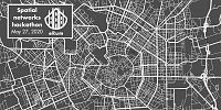
›eRum2020 satellite event: Hackathon on Spatial Networks

-
› Working language
English
-


-
Updated on 2020-05-09 08:23:00
The information is outdated?.


 Online
News - 16th April 2020: Restructuring the Hackathon. We decided to follow the lines of the e-Rum2020 conference and we trasformed our event into an online hackathon. We also added a webinar presentation of the sfnetworks package. More details in the next paragraphs.
Hi everyone!
R is becoming an increasingly popular language for interactive geographic data and graph analysis thanks to robust and well-maintained packages like sf and igraph/tidygraph. Spatial networks, such as transport networks, river basins, power grids and geolocated social networks, have both a graph and a spatial nature that can be better understood and analysed when represented in a clear and consistent class system. At present, however, no mature, well tested and 'tidy' class exists for spatial network data, representing a gap in R’s spatial and network analysis ecosystems.
For these reasons we invite you to join an online webinar and a hackathon on spatial networks on the 16th of June as official satellite events of the e-Rum2020 conference. The events will be focused on introducing and testing of the new R package on spatial networks: sfnetworks. We recently released the version 0.2.0 "Neutor" of the package and you can read the first introductory vignette here.
Following the lines of the e-Rum2020 conference, we decided to transform our previous hackathon into a fully virtual event which will be structured as follows. In the morning we will organize an online webinar to present the basic functionalities of the package, while, in the afternoon, you can join one of us (and other experts in the field) to work on one problems related to spatial networks in R. We will add more details on this point over the next weeks. The webinar and the hackathon are part of a single event, but you can use the same (free) eventbrite ticket to take part into just one of them.
Anyone with an interest in spatial networks and open source software is invited, especially if you have experience with real world spatial network data that could be used in documentation or experience developing software for working with spatial or graph datasets (particularly R packages).
We want to offer an effective, easy-to-use package and we think that the best way to start would be to tackle real problems that R users in this field face. Hence, participants are encouraged to propose their own problems using our GitHub issue tracker with the ad-hoc hackathon template and labels. We are going to explore a few of these issues and create Pull Request (or just feedback comments) to improve the package.
Summary
What: A webinar and a hackathon on spatial networks where we will present our new R package and work with the participants on problems they face dealing with spatial networks.
Who: Everyone working on or interested in spatial networks can join the events. The only minimal requirement is a basic knowledge of sf and igraph packages. We will provide a few vignettes explaining how our package works, so you don't need to be an expert in the field. This is the first introductory vignette.
When: 16th of June, 10AM to 5PM (GMT + 2).
Where: These are online events so we are going to use tools like Zoom, Slack and Gitter. We will provide more details as soon as possible.
Tweets by spaceagenda
Track this event on your Apple calendar